Hello Fall….or Winter???

This week has been a true Colorado weather experience.  Spring to Winter, this week has delivered all 4 seasons.  From 70s on Monday to Denver’s first snow storm of the season on Tuesday night, and with promises of 60 degree temps this weekend, who knows what season it is!

We made it through our first Colorado snow storm with ease.  Almost 8 inches of snow, but roads were clear so it was no problem traveling to and from work.  The wet, heavy snow left over 140,000 residents without power, but thankfully we weren’t included in that number.   A snow day at home would have been fun, but I’m afraid those will be few and far between with these fearless Coloradans!

Furry B Loves the Snow

One foot in front of the other… My first 14’er.

So, watching the snow creep further down the faces of the front range mountains here in mid October, I realized my goal of climbing a 14’er our first year here was quickly fading away…  We had our first snow of the season last weekend and the mountains got hammered, with Wolf Creek Ski Resort already opened.  I noticed we were supposed to have a quick warm up this week, so I started thinking I might be able to squeeze my hiking goal in, but I only had one shot…

It has been said, that hiking Colorado’s 14er’s is an immediate addiction.  Living near them and seeing them daily, hiking around them and fishing in the many lakes and streams in the area are one thing, but to actually hike a 14’er to the top, that is what it is all about.  I have been a long time researcher on www.14’ers.com getting trip and route data, conditions and packing suggestions and just general information.  A 14’er is defined as a mountain that exceeds 14,000 feet above sea level and the great state of Colorado has 53 of them (some say 54…) more than any other state.  There are some technicalities on how they are measured, but you get the point.

We have many 14’ers right here close to home, but I decided to attempt Pikes Peak for my first one (for years Pikes Peak was believed to be 14,110 feet.  It’s actually 14,115 feet.  Measuring equipment has improved and the sign has not caught up).  What better mountain to start with than “America’s Mountain”.  This is the mountain that inspired Katharine Lee Bates to write “America the Beautiful” in 1893.  Another big deciding factor was that I was to attempt this climb solo and I knew this was a popular trail and would come across people if I needed something.  There are two main routes to the summit.  The trail I was going to take is Barr Trail (east slope) and it is the longest (14 miles) of any trails leading to the top of the 54 mountains in Colorado that are over 14,000 feet, and offers the greatest base-to-summit elevation gain in the state: 7,400 feet.  Let the planning begin.

After watching the summit webcams for over a week, I could see some snow melt and Saturday, October 15th was supposed to have highs in the upper 70’s in Manitou Springs (at the trail head) and highs in the upper 20’s on the summit.  There is a guy I work with who has climbed this route a few times, so I got a lot of information from him.  I started putting my gear list together, as this was different from any other hike I have attempted.  I would be hiking through 4 different “life zones” (the foothills zone, montane zone, sub alpine zone and alpine zone) http://pikespeak.us.com/Learn/life-zones.html.  This would require more and different types of gear, aside from just layers of warm clothing.  I invested in some Micro-spikes to help with traction in the snow/ice, gaiters to help in the deep snow and trekking poles.  Not all of this is necessary, but I am very glad I invested…

To summit a 14’er in the summer months, the single most important factor is time.  Simply put, you need to have reached the summit and back to shelter before thunderstorms move in.  Lightning strikes are the biggest killer on mountains.  Many people try to summit a 14’er and get within a few miles of the top and have to turn around because of the weather and deteriorating conditions.  Weather at these altitudes is extremely unpredictable.  Since it is October, I didn’t have to worry about thunderstorms, I did however want to be off the mountain before dark and didn’t know what my pace would be and how long it would take.  I was told 6-10 hours depending on endurance and frequency of stops.  I decided to leave at 4am.

K, Furry B  and I drove down to Manitou Springs after work on Friday and stayed in a hotel near the trail head.  We woke up early in the am, packed, made sure I had everything and headed to the trail.  It was a short 5 minute drive down the road.  I borrowed two hand-held radios and due to little to no cell service I was to contact K via radio at certain times and when I reached the halfway point, Barr camp http://www.barrcamp.com/.  Barr camp was 6.5 miles up and for me, was the point of no return.  If I went past Barr camp I was going to attempt to summit, if not, I was to head back down to the trail head and meet K.  I knew there was snow, but I wouldn’t know if it was passible until I reached the camp and spoke to the caretakers.  We said our goodbye’s, went over final contingency plans and K made one final call to the information line.  Everything came to a grinding halt.  Due to time restraints, my original goal was to hike to the summit and have her pick me up there.  A lot of people hike to the halfway point, stay the night at Barr camp and then summit the next day.  I wanted to attempt the entire hike in one day.  The information line said Pikes Peak highway was closed 4 miles from the summit because they could not get the road cleared of snow.  I told K to drive as far up to one of the pull offs as she could, I would summit and walk the 4 miles down the road to meet her.  We stuck to the plan and I was off at about 4:09am

I headed to the trail head sign and into the dark canyon with my headlamp on, the twinkling lights of Manitou Springs fading behind me.  About twenty minutes in, I realized I was sweating and needed to shed some clothes.  It was about 35 degrees when I started and I would need these clothes later and I needed them dry.  I put them in my pack and continued.  It was an eerie feeling hiking in the dark with a head lamp and the almost full moon, but it was very peaceful.  I was in awe of the landscape being lit up by the moon.  Switchback after switch back, I slowly made my way up the trail.  I never heard, or saw anyone for the first two hours, then I saw a headlamp flickering through the trees.  I met up with a guy that was from Colorado Springs and was attempting the same plan I had.  He had hiked to Barr camp the previous weekend to scope it out, so we decided to stick together.  We rounded a bend and before us was the first glimpse of Pikes Peak from the trail.  It was still dark, but the moon was reflecting off the snow covered peak and hopefully in a few “short” hours, we would be on top.  About an hour after we met, the colors in the sky began changing and the sun peeked over the horizon east of Colorado Springs.  We were still in the treeline, so our view was a little obstructed, but we stopped for a few pictures, some water and then kept going.  After walking in the dark for almost 3 hours the sun was a welcome sight.  We arrived at the primitive, but welcoming Barr Camp, built in 1921 by Fred Barr (hence the name of the trail) around 7:30am.  We were welcomed by the permanent caretakers, went inside to warm up and ate some breakfast (trail mix, jerky and Cliff bars).  The caretakers hike all supplies in, or it is delivered by the cog as there are no roads.  The snow was spotty at this altitude, but there were people heading up the trail, so I tried to contact K via radio, with no luck.  I was able to get one text message out, saying we were heading to the top and should be there around 1:00-2:00pm.  We repacked our bags, strapped on the gaiters and micro-spikes and headed up.  By this time, my legs were already feeling tired and I could feel blisters beginning on my heals.  This was not going to stop me.  Further up the trail, the snow started covering the trail more and more.  We pressed on and reached the treeline at about 12,000 ft and knew we had about three more tough hours to the summit.  The snow was getting deeper in spots and my feet felt like cinderblocks.  We briefly stopped and talked to two guys who we yielded to.  One of them does this trail frequently throughout the year,  has climbed some of the most famous peaks and uses the Barr trail as a training ground.  I was glad to be following them.  Looking up, we were on the east face of the mountain.  The wind was ferocious at times, which didn’t help when you were on the side of a mountain at the mercy of the elements.  This part of the trail was by far the toughest and with each switch back, there seemed to be no end.  The views here were unbelievable.  We got off track a few times because of the depth of the snow, losing the footprints of whoever was in front of us.  After one more long trek across the face, we headed up to the “16 Golden Stairs”, which is more like 32, as they are switchbacks…  We were postholing in some spots above the knees, which made it that much more grueling.  We came around the last switch back and reached the summit at 1:30 that afternoon, 9.5 hours from start to finish.  Not bad for first timers with the snow conditions that were present.

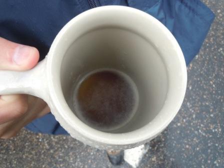
What an indescribable feeling to be finished!! We went to the summit house took some of our gear off and sat down.  We found out that they had cleared the road and it had opened at noon, so no 4 mile hike down to the car.  It was funny to see the tourists who had driven, or taken the cog railway up looking at you like you are crazy.  With our red, wind burnt faces and wet, snow-covered boots, I guess I could see why.  I stood in line for a world-famous Pikes Peak doughnut and coffee and the cashier said with a grin, how was the trail?  I checked my phone and had a message, K was almost to the summit for our ride down the mountain.  We finished up and went outside to get the famous summit picture by the Pikes peak sign.  Another tourist came up and said, you guys hiked all the way from the bottom, with a smile, I said yup.

This slideshow requires JavaScript.

Hello Fall!

Fall has arrived and in the mountains the Aspen leaves are changing from summer green to vibrant yellow and golds.  The Aspen leaves are strikingly different from the East coast’s mixture of deep red, orange and gold colors; but they are just as beautiful.

We took a weekend drive toward Estes Park to catch a glimpse of the Aspen golds and enjoy a little shopping in Estes.

This slideshow requires JavaScript.

Meeker

Oh Meeker…The Perfect Place to Be!

Land of Peace and Perfect Scenery.

With Rolling Hills and Friendly Faces

This is One of My Favorite Places.

How I Wish I Could Stay With Thee,

But We Must Return to the Sea of Humanity.

We picked up a couple of traveling companions and began a road trip to Meeker to spend a few days with family in this Western paradise.  Meeker is well-known to hunters, but the area also offers wonderful scenery and outdoor adventures.

With the perfect hosts, we were greeted with a fish and elk fry the first night with friends, family and neighbors.  We ate until we could eat no more!  And thanks to Grandpa J, Furry B was even able to enjoy a few bites of elk. The next day was spent shopping, fishing, and then rounding up the crowd to head to the Elk Camp.

Elk Camp!

By hunter’s standards, the camp was almost luxurious; with electricity, satellite tv, and a commercial kitchen, this hunting cabin should be featured on HGTV.  We grilled up a few burgers and headed off to the mountains in search of elk.  Since it is the breeding season, we hoped to see lots of elk gather in the vallies in search of mates.  Up the mountain, we stopped for several photo ops and enjoyed the view of the rolling mountains.  We reached the ridge, and almost immediately could hear the elks’ bugles.  About the second valley we stopped at, we were able to spot at least a dozen elk gathering in the field below.  We stayed on the ridge until sunset, and then drove back down to camp.  After a few snacks, we cleaned up camp and headed back on the road.  On the way home, we saw multitudes of mule deer and then had a movie worthy moment when a huge elk appeared in the middle of the road!  Thankfully, our brakes were in good condition and we were able to stop before the truck became an elk slayer (or the elk becoming a truck destroyer).

Trappers Lake

Our last evening at Meeker was spent at Trappers Lake Lodge.  On the scenic drive to the lodge we passed the $55 million Seven Lakes Ranch owned by golfer Greg Norman and beautiful property owned by American businessman Henry Kravis.  As we neared the lake, we saw the devastation of the 2002 fire, which burned over 22,000 acres including the original lodge.  The lodge has been rebuilt, and includes a restaurant and small store.  We had made reservations for dinner and in true Meeker style, even brought lettuce and tomatoes for the kitchen (since the nearest town – Meeker – is 39 miles away).  The dictator restaurant, where they dictate what you eat, served Navajo Tacos on Indian Frybread with a choice of chicken or ground beef.  And they were delicious!!!!  After dinner, we took a stroll over to Trappers Lake, which is one of Colorado’s largest natural lakes.  It was late in the evening, but there were still a few fishermen and kayakers enjoying the calm waters.

The next morning it was sad to go, but we were glad for the good memories. Meeker is the perfect Colorado retreat!

This slideshow requires JavaScript.

Oktoberfest

O’zapft is!

Welcome to Breckenridge – the Home of Colorado’s largest Oktoberfest celebration.  (The “original” Oktoberfest in Munich is the largest fair in the world.)  The weekend celebration was filled with German music, German food and of course German beer.  Even with the periodic rain and sleet, everyone had a great time.   The crowded streets would cheer everytime the rain stopped and the sun peeked out.  Next year we will be more prepared with umbrella and gloves….You never know what type of weather to expect in the mountains.

Fishing the North Platte River, CO

Labor Day weekend, where to go???  We decided to pack the Cruiser and head even further away from humanity to a more desolate area of the state, North Park, CO.  We took the scenic route: 70 West to Empire, 40 North through Winter Park and Granby and then North on 125 through Walden to the North Platte River.  We had not been here before, so we scouted out our surroundings.  We found the ramp area on the river where I wanted to start fishing, so we needed to find a camping spot nearby.  Luckily, there was a forest service/4×4 road about 2 miles south of the Wyoming state line and decided to head up and check it out.  We were so glad we did.  There were three primitive camping spots on the ridge overlooking Northgate Canyon, called Mahogany Spur.  Unsure whether we would find anything being Labor Day, we were very glad to have found this area.  After we decided on a spot, we headed back to the river, ate lunch and geared up.  Furry B was frisky as the weather was a beautiful 70 degrees and I couldn’t wait to get the waders on and get a pole in the water. 

“The North Platte River is a legend – a river that pioneers used to traverse portions of the west – where Indians hunted buffalo along its shores. It is also a legend for fishing. Known for its good fishing in Wyoming, it starts in northern Colorado. A portion of this river has the distinction of being both a Wild Trout and Gold Medal River.”  http://www.coloradofishing.net/ft_nplat.htm

K and Furry B headed down the trail next to the river; I got right in and started wading downstream.  I started off with a flourescent rooster tail and wasn’t having any luck.  Remembering reading something about orange being very good on this river,  I threw an orange Panther Martin on the line and after a few minutes, got a hit.  It was a small Brown Trout and the only one we got a picture of, as I was in the middle of the river and K was on the bank with Furry B.  We got him back in the water and I headed back out.  Caught a few more browns and then I spotted a nice sized rock down stream, so I worked my way towards it.  As I got closer I could see the other side of it and it created a nice pool.  I casted near the rock and a nice sized Rainbow took the bait.  I decided I should call it a day, as I had talked to the only two other fisherman I saw, one didn’t catch anything and the other only caught one.  I was ahead of the game and we needed to set up camp.

We headed back up the forest service road, pulled into camp and started setting up.  We sat around and enjoyed the scenery from the ridge: the Northgate Canyon and Medicine Bow Mountains to the east and Independence Mountain to our west.  Furry B wore himself out chasing all the chipmunks, which were in abundance.  The sun was going down, so we fired up the grill and made hotdogs along with blue cheese and bacon potato salad,which I thought was great!  K said it tasted like dirty socks, guess I like dirty socks…  As the sun went down, so did the temps.  We made a fire and turned in early.  When I got up with the sun rising over the mountains to the east, peaking in the tent window, it was 38 degrees.  K stayed in her warm sleeping bag and I got up to make some coffee.  We made a gourmet breakfast with scrambled eggs, mushrooms, asparagus and cheddar cheese, mmmmmm.  We were in no hurry to pack up, but we had passed a wildlife area coming in that we wanted to check out. 

After packing everything up, we headed south, back to Walden.  We took a detour on the right which was BLM area, McCallum Oil Field.  It began in 1926 and in 2007, North Park produced 96 thousand barrels of oil and 1.3 billion cubic feet (BCF) of natural gas from 153 wells.  Pretty vast area.  We also took drive through the Arapaho National Wildlife Refuge.  We saw lots of pronghorn antelope, prairie dogs and a sneaky coyote.  As we were nearing town, we saw an antelope that was stuck in some barbed wire, we stopped to help and as I walked back to the truck to get some gloves, K was getting a better view of it and it got loose, yelled at us and ran off to join the herd that was about 200 yards away.  We fueled up in Walden and took a different route home, through Wyoming and then south into Denver.

This slideshow requires JavaScript.

Final Day – Cruise the San Juans

Day 3 – Black Bear Pass and Bridal Veil Falls

We awoke early to pack up camp and then headed out to conquer one of the most challenging and “puckering” trails of the weekend.   The trail entrance to Black Back Pass was just a short drive from our campsite.  Once again the scenery did not disappoint…. The roadsides were covered with wildflowers, including the white and lavender Columbine which is Colorado’s state flower.  We also passed under cables still attached to the mountain sides.  The miners used the cables to transport themselves and supplies to the other side.  After reaching the summit at 12,840 feet, we stopped for photos with an amazing Rocky Mountain background. 

The descent was made up of a series of switchbacks which overlook the town of Telluride.  The switch back turns were slightly precarious and required a spotter at most turns (and a tight grip on the inside passenger door handle).  With loose rocks and no room for error, the switchbacks could definitely make one “pucker.”  View this link to see a great picture of the “infamous switchbacks:”  Black Bear Pass Switchbacks

The end of the trail rewarded us with an AMAZING view of Bridal Veil Falls – one of the highest waterfall in Colorado.  It is a site to see with a working house/power plant sitting on top of the 365 feet falls.  With a short ride the rest of the way down the mountain to Telluride, the 1st Annual 100 Series Cruise the San Juan’s came to an end for us and we began the drive back home. 

We are already planning next year’s event,  which promises to have even more Cruisers.  So, if you haven’t yet, go buy a Land Cruiser and we will see you at the camp fire!!

This slideshow requires JavaScript.