Camp Cooking – Halloween Edition: Funny Bones

For all of you fall campers, here is a sweet and salty halloween treat that can easily be made with the family at the campsite or made ahead of time at home.

Funny Bones (photo from www.epicurious.com)

Funny Bones (photo from http://www.epicurious.com)

They’re so simple and very spooky.  We took them on last year’s Spooky Run and they were a big hit.

FUNNY BONES

Ingredients:

1 (12-ounce) package white chocolate chips (2 cups)
36 pretzel sticks and rods of various sizes
72 mini-marshmallows (about 1 cup)

Directions:

1. Line a rimmed baking sheet with parchment or wax paper.

2. Place the chips in a double boiler over just-simmering water and melt, stirring frequently. As soon as the chips are just melted (there may even be a few solid ones left), remove the pan from the heat and remove the top section of the double boiler so the chocolate’s temperature doesn’t keep rising.

3. Stick marshmallows onto both ends of the pretzels, with the marshmallows’ flat sides parallel to the pretzel.

4. Dip each pretzel in the chocolate and lift out with a fork, letting the excess drip back in the bowl. Lay the bones on the baking sheet and refrigerate for 30 minutes to harden the chocolate. Store in an airtight container in the refrigerator or at a cool room temperature.

You can find more Halloween treats in the Ghoulish Goodies cookbook:

http://www.amazon.com/gp/product/1603421467/ref=as_li_tl?ie=UTF8&camp=1789&creative=390957&creativeASIN=1603421467&linkCode=as2&tag=livi08a-20&linkId=PCWMVJVOFJRSMZF3

Georgia Pass – Summit County, Colorado

Georgia Pass Road #355

Every Fall we always try to take at least one day trip to find Aspen gold.   This year we found an offroad trail with a little challenge and a little scenery — Georgia Pass.   This pass connects the towns of Jefferson and Breckenridge and was once a late 1800’s stagecoach trail that carried passengers from the Jefferson railroad terminal into Breckenridge and surrounding communities.


Trail Name: Georgia Pass

Trail Length: 11.6 miles

Highest Elevation: 11,585 feet 

We decided to enter the trail from Tiger Road just outside of Breckenridge, since this section of the pass was the most difficult. This part of Summit County used to be an active mining area and home to many small mining communities that have long since disappeared.

Georgia Pass

Our ascent up Georgia Pass was steep, narrow, and rocky.  There are numerous spurs off the main trail, which can make the trail somewhat confusing to follow. The road is marked with forest service road markers, but they can easily blend in with the dense trees and brush.  If you go, just be sure to follow 355 signs.

Ascending Georgia PassView from Georgia Pass

After emerging from the narrow trail, we drove past tree line and were greeted with a magnificent view.  We were slightly disappointed that we had yet to see any Aspens, but once we reached the top of the pass, we were able to see the gold foliage awaiting us on the other side.

Georgia Pass 11,585 feet elevationGeorgia Pass – elevation 11,585 feet.  Mount Guyot sits in the background.

Driving Georgia PassDescending the pass towards Jefferson, the road is well maintained and easily traveled by all vehicles….And is surrounded on either side by glowing Aspens.

Aspen Gold and Blue SkyContrast of the golden Aspen leaves against the Colorado blue sky.

Georgia Pass goldThe golden leaves continued around every corner.

Community AspensAspen Field

Lucky folks to live amongst the Aspens.

Cows with a ViewStopped to say “Hello.”


Aspen Grove on Weston PassTree on Weston Pass

Gold Aspens Weston PassWeston Pass Aspens

Once we finished Georgia Pass, it was still early in the day, so we continued down the highway and explored a portion of Weston Pass.  We found a few more amazing displays of fall color.


If you are curious about the history of Breckenridge and Summit County, here are two interesting websites:

Good Times Adventures: Gold Fever in Our Backyard

Summit County, Colorado: Mining History

America’s Castles: Mesa Verde National Park

Life is about choices, and on labor day weekend we chose to have fun. We have house projects to do, money to save, and blogs to write…but somehow exploring always wins out unanimously. With a three day weekend awaiting us, we decided to drive to Southwest Colorado and explore Mesa Verde National Park. Mesa Verde is about an hour and a half west of Durango, CO so we set our sights on the park gates between Durango and Cortez, CO.

DSC04232DSC04217


Everything was packed the night before and Bandit was dropped off to visit his friends at the local boarding facility. Of course, we live for early and the Saturday 4am alarm was just that. We showered and grabbed a quick cup of coffee and we were out the door and on the road. Fall is definitely in the air and we enjoyed an awesome sunrise as we headed south on highway 285 with the dash temperature reading 35 degrees. A couple hours later, we made a quick pit stop for breakfast in Buena Vista and continued on our course southwest.

DSC04234We arrived at the Mesa Verde park headquarters around 1pm and quickly made our way inside to purchase tickets. There are areas of the park, which can be explored on self guided trips, but the better preserved cliff dwellings are led by Park Ranger guided tour only. Unfortunately tickets cannot be purchased in advance, but we arrived just in time to get the last tickets for the Cliff Palace and Balcony House tours later that afternoon. We had a couple hours to kill before the first tour started, so we drove the 45 minutes to the other side of the park and checked out the archeological museum. The museum had some unbelievable artifacts collected from the area and gave us a great introduction to what we were about to experience. The park is 82 square miles and houses the best preserved cliff dwellings in the world. They were built 800 years ago by the Pueblo/Anasazi Native Americans. The Pueblo lived in this area until the late 1200’s when they fled south because of a 24 year long drought.

DSC04244

We explored the museum with its Native American artwork , clothing, pottery, tools, and even a jar which still had corn in it. This jar and corn weighed 31 pounds and it dates between 1200-1276!! After our American history refresher in the museum, we hiked down a 3/4 mile trail to the self guided area of Spruce Tree House which was located just below the museum. This is where we got our first glimpse of a cliff dwelling. It is completely mind boggling that something made of mud, straw and dirt is still standing after 800 years. Because of the dry climate and the natural shelter from the cliff overhangs, we are still able to visit this area and see how these great people once lived. There are over 600 cliff dwellings in the area which are still being explored and excavated. They are essentially small villages built into the rock and you can still make out the different rooms that were used for storage, living space and even ceremonial areas. Some of the original colored plaster is still visible on the walls and there is a reconstructed kiva that you can climb a ladder down into.

IMG_5362

Ancient corn

IMG_5450

After fully exploring our first cliff dwelling, we were excited to see what the actual guided tour had in store for us. Heading back up the trail to the parking lot we passed the out of state tourists who were huffing and puffing because of the 8,000 foot altitude. We drove down the road a few miles to the Cliff Palace tour and listened to the ranger give a great historical background of the area before we headed down into the canyon. The Cliff Palace tour was the easiest of the two we signed up to do. This one required a moderate hike down into a canyon to actually get to the dwellings and then we had to climb a few ladders and a rock stairway to get out. The Cliff Palace is probably the most photographed and largest of all the cliff dwellings and you do not realize how big it is until you are standing at its base looking up. It is estimated that 100 people lived here and it may have served as a social and administrative site. When they were built, the Pueblo started at the back of the cliff wall and worked their way out. This allowed space for about 150 separate rooms, some of which still had soot on the ceilings from their cooking fires. We were not allowed to go inside any of these rooms, but we were able to walk around them and look in the windows and doors. One structure, amazingly still had original artwork painted on the walls.

IMG_5403Once we climbed out of the canyon from the Cliff Palace we headed over to our last tour at the Balcony house. The long tunnel that you have to crawl through, tall ladders and steep rock steps make this “the most adventurous tour in the park.” It is not difficult, but unfortunately there are some people who cannot go on this tour. That being said, I told Kristy to look behind her at the view of the canyon when she was on the 30 foot ladder and she refused and quickly climbed to the top. The Balcony House is much smaller than the Cliff Palace, but because it sits further behind the lip of the cliff overhang, it is one of the best preserved in the park. All the cliff dwellings have had reconstructive work done, but none of the work takes away from the original construction. I think most of the work was done to preserve it from further deterioration and they did a remarkable job matching the existing materials. Since we had already seen three dwellings, the best part of this one was the ladders, tunnel and chain we had to climb to get out. In true JKBAdventure fashion, we managed to squeeze into what was suggested for 2 day trip in the park into 3/4 of a day.

IMG_5465 DSC04276After the Balcony House tour, it was getting late, so we drove the 45 minutes to the park entrance to our campsite for the evening. It was time for dinner, so we quickly set up the tent and drove back into Cortez to find some chow. Thanks to Yelp we found the Shiloh Steakhouse and decided to give it a try. Kristy had the beef tips and a salad and I had the chicken fried elk paired with a Durango Amber Ale; both meals were excellent. We cruised into camp well after dark and hit the rack; we had big plans early the next morning.

To be continued…

This slideshow requires JavaScript.

Late Summer Hike


4:00 am…on a Saturday…and my alarm clock is ringing in my ear.  We crawled out of bed, showered, loaded our packs in the car, and headed down the highway at 5:15 am.  Call me crazy, but sometimes early morning wake ups make for the best days.

Early Morning Hike

Heading West to our destination, we timed it right and missed the weekend mountain traffic arriving to a mostly empty parking area.  The air was a brisk 42 degrees and windy at 11,000 feet which made Bandit all the more frisky as he jumped from the Outback.  It has been too long since we have taken a family hike together, so we were happy to breathe in the clean mountain air.  Chilly TempsWe picked a shorter trail with good scenery that was friendly for dogs (with a titanium leg).  The hike ended at an alpine lake, so Josh brought along his fly rod to try his luck.

Somewhere in ColoradoThe chosen trail (undisclosed) turned out to be a perfect choice.  It was 4.2 miles out and back and surprisingly, many wildflowers still remained this late in the season.  As we hiked up the trail, we encountered a few small stream crossings, waded through patches of willow thickets, and spotted six mule deer on a northwest hillside.  Reaching the top of the ridge, the wind was fierce and almost unbearable.  We pushed through to reach the next part of the trail where the mountains provided a barrier from the brutal gusts.  Red paintbrush, mountain gentian and tall fringed bluebells enveloped both sides of the path, which became marshy in spots as we reached our glacial lake destination.

Colorado Mountain Stream

Willow Thickets

The alpine lake was peaceful, calm, and surrounded by mountains and wildflowers.  After enjoying a well earned trail snack of cheese and jerky, Josh fished for a while, while Bandit and I enjoyed the views.  We took our time exploring the area and made a loop around the lake.  With clouds steadily rolling in, we decided it was time to depart and we began our decent.  Bandit met a few doggie friends on the way down, and then started losing his energetic enthusiasm as we crept closer to our four mile completion.

Bulldog and Flowers

Hiking and mountain air always leaves us famished, so we decided to stop in Georgetown for a quick lunch.  Yelp assisted us in our choice of Lucha Cantina.  Lucha is located on 6th Street in Georgetown’s National Historic Landmark District. The menu is quite varied and they use all fresh ingredients; I ordered enchiladas, while Josh picked out one of the mac & cheese combos.  The food and atmosphere was a great ending to our morning adventure and reenergized us for the drive back home.


Molly Brown House Museum

Molly Brown House & MuseumWe love the mountains, but we also love Denver and all of the history and western cultural it has to offer.  Denver’s Pennsylvania Street is filled with historical significance and beautiful residential architecture that will never again be duplicated.  One of the more infamous homes on this street was once owned by the “Unsinkable” Molly Brown.  Of course, we all know her from the Titanic tragedy, but she lived quite the storied life after the sinking.

After making millions from the silver mines in Leadville, Colorado, Margaret “Molly” Brown and her husband took residence in their Denver home in 1894 and lived there for many years.  The 1889 stone exterior of the home was designed by a well known architect and its three story interior had many modern conveniences such as indoor plumbing, which was unheard of at the time. The home at 1340 Pennsylvania Street is now open to public and we were lucky enough to take a guided tour of this grand home and hear the details about the life of Molly Brown.

From a young age, Molly was a strong and independent woman.  She and her brother left the family home of Hannibal, Missouri with dreams of living in the west.  She found herself in Leadville, Colorado and soon met and married mining engineer J.J. Brown.  Once the couple moved to Denver, Molly quickly involved herself in social reform and philanthropy.  New found wealth also allowed Molly and J.J. to fall in love with world travel.  Molly became internationally known after surviving the sinking of the Titanic and helping other survivors who lost their families and possessions.  This led to her interest and involvement in politics and the suffrage movement.  Molly was “free, liberated, and self-sufficient.”

“I go anywhere that I am needed.” ~Margaret Brown

Read more About Molly Brown and Molly’s House.

The Molly Brown House Museum provides a glimpse of Molly’s “unsinkable” spirit and life in Denver over 100 years ago.  Support Historic Denver and plan your visit to 1340 Pennsylvania Street.

Thanks to the Scientific and Cultural Facilities District (SCFD), you can visit Molly Brown House for FREE on selected days throughout the year.  Visit the SFCD website for more info.

**2014 SCFD Free Days For All Visitors: November 11 & December 3**


July 4th Road Trip: Meeker Range Call, Independence Pass and Leadville

Shooters in Rifle

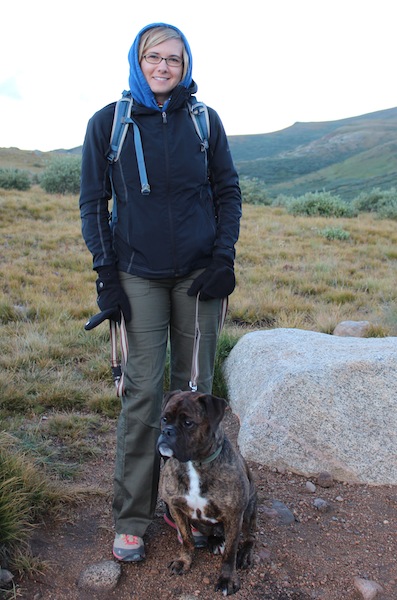
Kristy at Shooters in Rifle, CO. Note the sticker on the door.

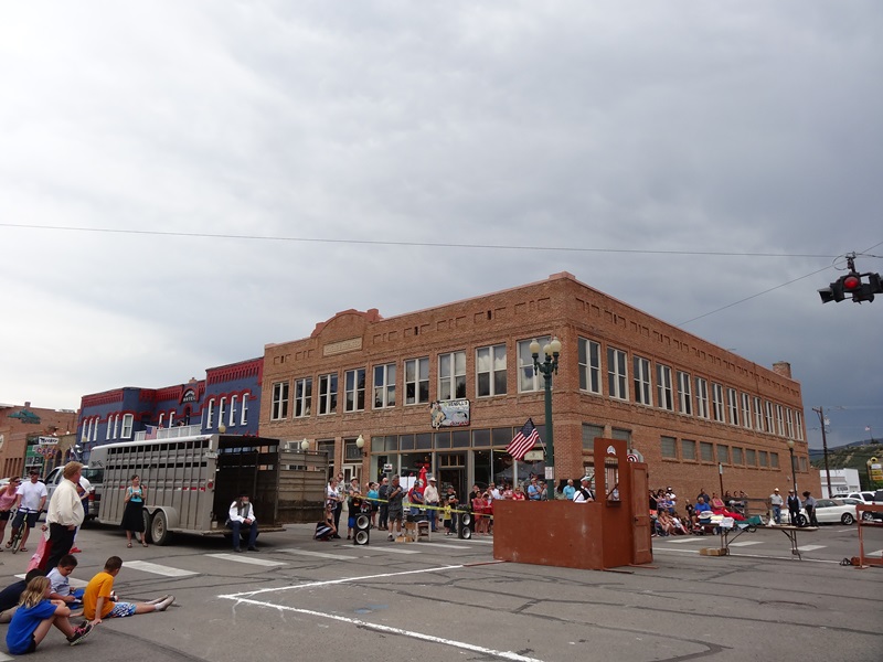
Driving I-70 west on a holiday weekend is a daunting task, so we left promptly at 6am on Saturday to get ahead of the traffic. We had plans to spend the Independence Day weekend with family in one of our favorite Colorado destinations, Meeker, for Range Call 2014. After our 3 hour drive, we stopped in to have breakfast and to support a local restaurant, Shooters Grill in Rifle. They recently made headlines for allowing employees and patrons to “open carry” firearms. Kristy ordered a breakfast burrito the size of a football, which she barely touched, and I had Angus corned beef hash and eggs. Breakfast was excellent and up the road a ways, we arrived in Meeker just in time to catch the parade. After watching the parade in the hot sun, we welcomed the shade at the BBQ afterwards hosted by some friends of the family. We relaxed and visited with some great people and chowed down on the never-ending buffet of fresh barbequed pork and lamb and every side dish, salad and dessert you can imagine.

BBQ

BBQ

The hosts did it up right and spared nothing. From the kegs of beer and fresh lemonade and tea, to the tents and tables sitting on the freshly manicured lawn right on the White River. It was one of the better 4th of July BBQs I have been to.

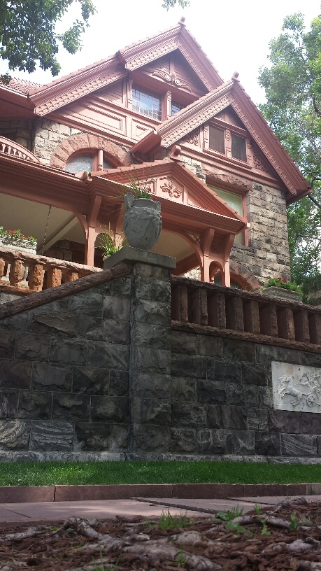
Rejuvenated from the food and cold drinks, we made our way over to Main Street to watch the reenactment of the famous Meeker bank robbery that took place on October 13th, 1896. With the help of the 100 year old Meeker town historian, every year a group of locals acts out the bank robbery in front of the Hugas Building next to the Meeker Hotel.

Hugas Building

Hugas Building

Using authentic props and a little humor, this historic gunfight plays out in the same location it originally occurred almost 120 years ago. There have been a few minor changes since then; the streets are now paved, a few buildings have gone up and the three would be robbers have a permanent view of their mistake from the cemetery above town. An affirmation to this day as to why our 2nd Amendment is so important.

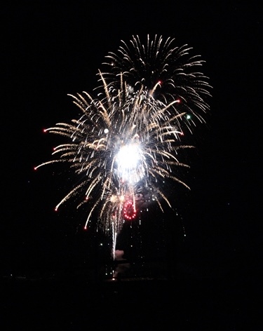
What would the 4th of July be without fireworks? The festivities came to a close with a great fireworks show that we were lucky enough to watch from Linda and Joe’s deck. What a perfect setting with the Grand Hogback mountains as a shadowy backdrop.

boom

Boom

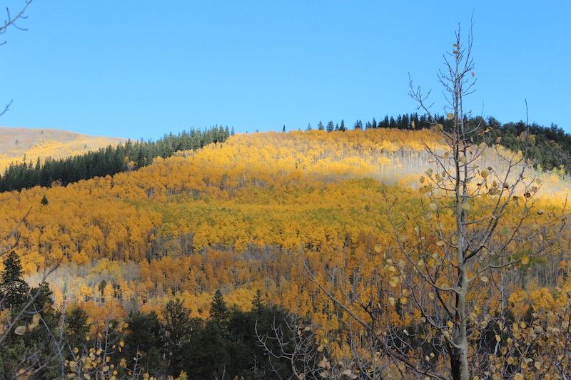
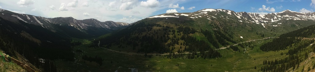
We always hate to leave Meeker, but the time had come. We ate breakfast with the family and hit the road taking a different route home on Highway 82 in Glenwood Springs and then through Aspen. Leaving on a Saturday we were not in a rush to get home, but we didn’t want to push our trip into the madness heading back to Denver on Sunday. The plan was to drive over Independence Pass (on Independence weekend) and into Leadville and then on to Denver. On our way up the pass, we stopped at the ghost town of Independence. It is one of the better preserved ghost towns in the state and yes, it got its name because gold was struck there on July 4th, 1879. In its heyday it had 1,500 residents, 47 businesses and 5 saloons. After producing $190,000 worth of gold, the winters became too much for the miners and many relocated to the newly named Pitkin County seat, Aspen; and by 1912, Independence was completely deserted. The Aspen Historical Society has done a great job restoring and maintaining what is left of the ghost town. They even restored the old general store and turned it into a small museum with mining artifacts and old photos of Independence. Of course the intact buildings are boarded and locked up in winter, as the snow all but covers them.

Independence Pass

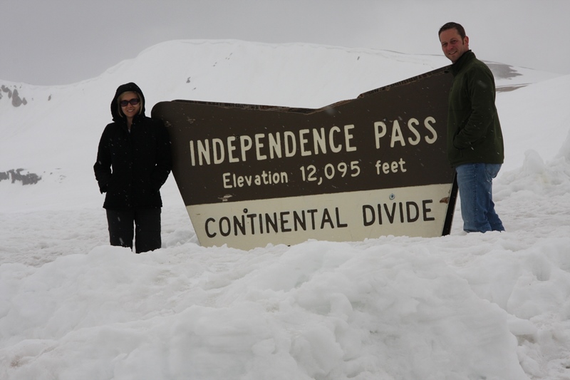
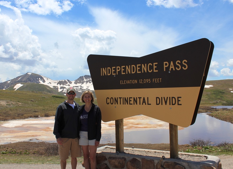
The last time we drove Independence pass was a few years ago and it was the weekend it had re-opened for the season. You could barely make out the rooftops of the mining remains at Independence, there was a lot less snow this time… (Pics below are of the exact same sign).

Spring 2011

Spring 2011

July 5, 2014

July 5, 2014

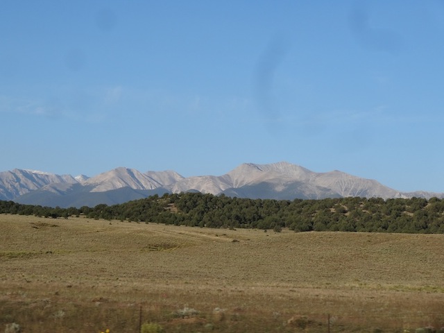
We descended the 12,095 pass into the twin lakes area and headed north to Leadville. Leadville is another mining town that was founded in 1877 and is still a very active town with about 3,000 residents. It is the highest incorporated city in the United States at 10,152 feet. As Denver is known as the Mile-High City, Leadville’s nickname is the Two-Mile-High City. The Historic District boasts some awesome 19th century architecture and the detail and craftsmanship is amazing. Leadville is home to some notable historical structures such as the Tabor Opera House, the Delaware Hotel (supposedly haunted) and the Silver Dollar Saloon, where Doc Holliday is said to have had his last gunfight before his passing in Glenwood Springs, CO of tuberculosis. Leadville is a really cool town with a lot to do and it is surrounded by some of Colorado’s highest mountains (Mt Elbert and Mt Massive). After a quick bite to eat at High Mountain Pies, which we highly recommend, we headed back to the Mile-High City.

Mountain Pie

High Mountain Pie with Mt Elbert in the background.

See ya in the mountains!

This slideshow requires JavaScript.

Ghost Town, Gunnison & Crested Butte

This slideshow requires JavaScript.

We took a road trip to south central Colorado to see the final colors of fall.  With Gunnison and Crested Butte as our destination, we made a few stops along the way to enjoy the scenery and see a few new sites.  A couple hours into our travels, we veered off the beaten path to find a Colorado ghost town.

Saint Elmo was established in 1880 and originally named Forest City because of its remote location.  It was founded to support the men working in the nearby mines and at its height was the largest town in the area with almost 2,000 residents.  In 1890, part of the town was destroyed by fire and never rebuilt.  By 1900, the town population was only 64 residents.  However, the Stark family ran the general store until the 1950’s until Annie Stark, the last of the siblings passed away.

After finding no ghosts at the ghost town, we headed onward to our destination via Cottonwood Pass.  We spotted some lingering Aspen gold along the pass, but the vibrant yellows and golds were soon exchanged for white snow as we reached the 12,126 ft summit of Cottonwood Pass at the Continental Divide.  Here we stopped to stretch our legs and let Furry B romp in the snow.  This stop offered great snow capped views of the Sawatch (not Sasquatch) mountain range.  After snapping a few pics, we continued on the unpaved section of the pass into Taylor Reservoir, and on to Gunnison for the night.  Gunnison is surrounded by three mountain ranges, mountain streams and beautiful scenery, making it a haven for outdoor enthusiasts.  Even though the sun shines almost every day, it is also known as the coldest town in winter in the United States due to its location at the bottom of several valleys. Western State Colorado University calls Gunnison home, and its “W” located on Tenderfoot Mountain is the world’s largest collegiate symbol.  Their athletic facilities are also a world record holder, being recognized as the highest collegiate football field in the world at 7,750 feet.

For Best Video Picture, click on “Gear” symbol and select 1080 HD

After a night in the small mountain town, we continued our road trip to Kebler Pass, one of the world’s best places to view gold Aspens.  Being mid-October we may have missed the peak of the Aspen’s golden transformation, but  the drive did not disappoint.  There was still plenty of color to enjoy and it was fun to see the contrast between the fall colors and the recent snowfall.  With a successful photography session on Kebler Pass, we spent the late afternoon exploring nearby Crested Butte.  Crested Butte is one of America’s great ski towns, but the entire town only covers an area of 0.7 square miles.  Skiing has been the main town attraction since the 1960’s and Crested Butte also claims to have created the sport of mountain biking.  (Fun Fact: Many locals believe the movie Avatar is based on the town of Crested Butte.)

This slideshow requires JavaScript.

Fun with Leaves (Click FAST)